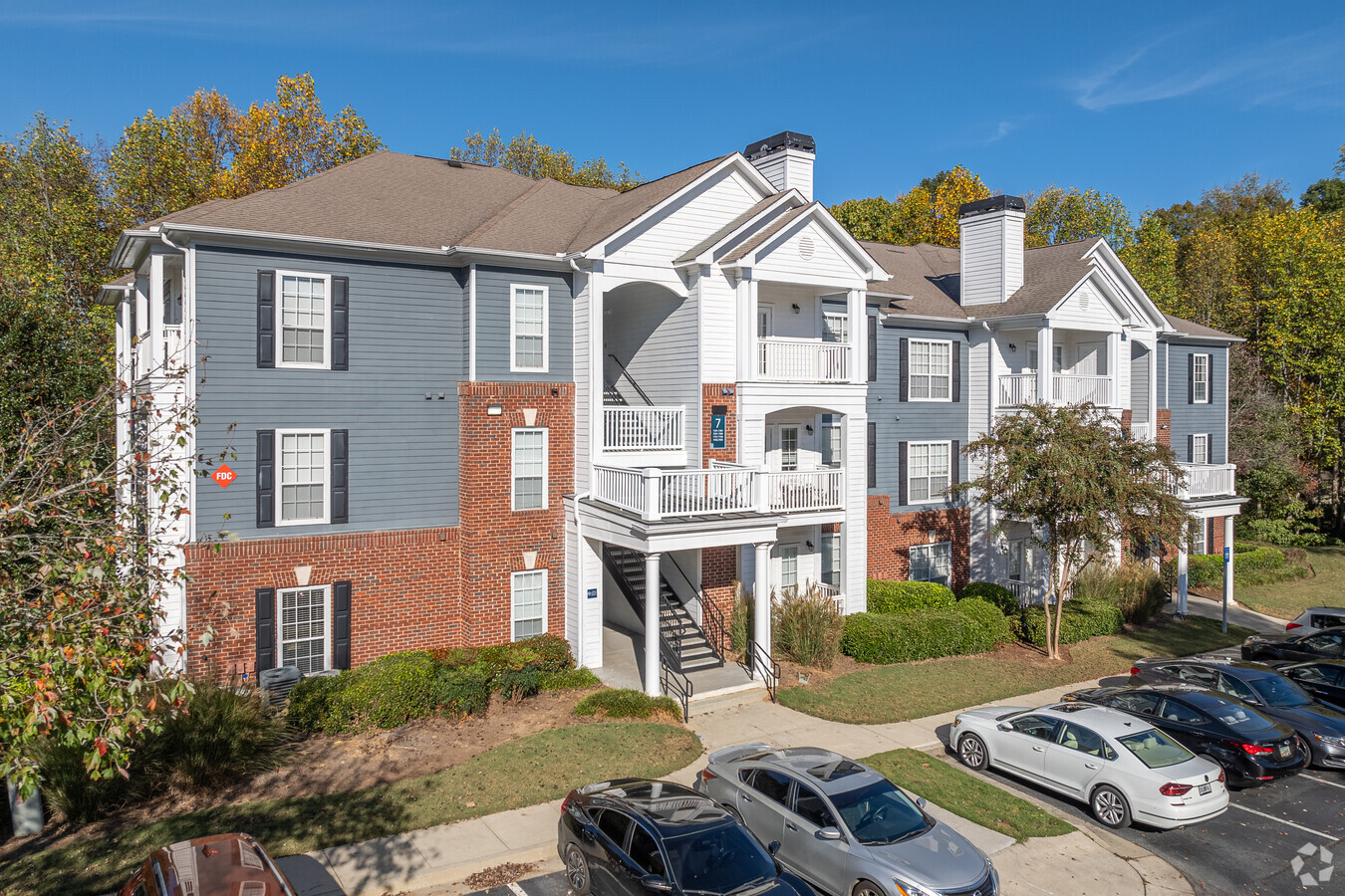
Property Record
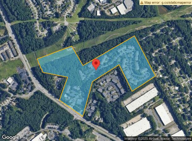
5375 Sugarloaf Pky, Lawrenceville, GA 30043
NEARBY LISTINGS FOR SALE OR LEASE
Property Detail
5375 Sugarloaf Pky
Atlanta-Sandy Springs-Roswell, GA
Berkeley Lakes Estates Sec 02
7-043-013
ATKINSON RD
Apartment
Gwinnett
AE
Georgia
13135C0071F
43
2024
35.71 AC
2023
Outer Gwinnett County
050562
Atlanta
379,346 SF
DEMOGRAPHICS near 5375 Sugarloaf Pky
1 Mile
3 Mile
5 Mile
2024 Total Population
10,936
100,614
241,495
2029 Population
11,429
105,042
251,653
Pop Growth 2024-2029
+ 4.51%
+ 4.40%
+ 4.21%
Average Age
36
36
37
2024 Total Households
3,790
34,790
83,068
HH Growth 2024-2029
+ 4.22%
+ 4.49%
+ 4.30%
Median Household Inc
$54,470
$65,390
$66,378
Avg Household Size
2.80
2.80
2.80
2024 Avg HH Vehicles
2.00
2.00
2.00
Median Home Value
$272,739
$274,676
$287,180
Median Year Built
1998
1995
1994
Nearby Places
- Restaurants
- Banks
- Shops
- Fitness
- Groceries
Nearby Properties
Address
Land Use
TOTAL SIZE
Lot Size
Zoning
Address
Land Use
TOTAL SIZE
Lot Size
Zoning
628,779 SF
97.15 AC
M1
Address
Land Use
TOTAL SIZE
Lot Size
Zoning
641,171 SF
43.12 AC
RM13
Address
Land Use
TOTAL SIZE
Lot Size
Zoning
344,203 SF
17.05 AC
MUR
Address
Land Use
TOTAL SIZE
Lot Size
Zoning
491,944 SF
38.60 AC
RM13
Address
Land Use
TOTAL SIZE
Lot Size
Zoning
483,319 SF
47.80 AC
RM13
Address
Land Use
TOTAL SIZE
Lot Size
Zoning
567,189 SF
47.90 AC
RM13
Address
Land Use
TOTAL SIZE
Lot Size
Zoning
1,300,470 SF
287.48 AC
M2
Address
Land Use
TOTAL SIZE
Lot Size
Zoning
441,948 SF
91.78 AC
OI
Address
Land Use
TOTAL SIZE
Lot Size
Zoning
522,601 SF
42.40 AC
RM
Address
Land Use
TOTAL SIZE
Lot Size
Zoning
272,196 SF
44.76 AC
RM13
Address
Land Use
TOTAL SIZE
Lot Size
Zoning
426,720 SF
38.98 AC
RM13
Address
Land Use
TOTAL SIZE
Lot Size
Zoning
327,680 SF
29.70 AC
RM13
Address
Land Use
TOTAL SIZE
Lot Size
Zoning
409,542 SF
35.94 AC
RM13
Address
Land Use
TOTAL SIZE
Lot Size
Zoning
438,488 SF
35.04 AC
RM
Address
Land Use
TOTAL SIZE
Lot Size
Zoning
315,806 SF
13.03 AC
MUR
Address
Land Use
TOTAL SIZE
Lot Size
Zoning
360,962 SF
32.67 AC
M2
Address
Land Use
TOTAL SIZE
Lot Size
Zoning
1,650,103 SF
112.95 AC
C2
Address
Land Use
TOTAL SIZE
Lot Size
Zoning
296,482 SF
14.90 AC
MUR
Address
Land Use
TOTAL SIZE
Lot Size
Zoning
389,385 SF
25.93 AC
RM13
Address
Land Use
TOTAL SIZE
Lot Size
Zoning
43,680 SF
20.98 AC
RM10-MULTI
Address
Land Use
TOTAL SIZE
Lot Size
Zoning
517,632 SF
77.07 AC
OI
Address
Land Use
TOTAL SIZE
Lot Size
Zoning
249,950 SF
19.97 AC
MUR
Address
Land Use
TOTAL SIZE
Lot Size
Zoning
298,350 SF
6.41 AC
RM24
Address
Land Use
TOTAL SIZE
Lot Size
Zoning
365,351 SF
30.70 AC
RM13
Address
Land Use
TOTAL SIZE
Lot Size
Zoning
295,829 SF
22.12 AC
RM13
Address
Land Use
TOTAL SIZE
Lot Size
Zoning
834,948 SF
70.76 AC
HM
Address
Land Use
TOTAL SIZE
Lot Size
Zoning
34,831 SF
10.17 AC
C2-GENERAL
Address
Land Use
TOTAL SIZE
Lot Size
Zoning
503,650 SF
34.37 AC
M1
Address
Land Use
TOTAL SIZE
Lot Size
Zoning
348,681 SF
35.52 AC
RM10
The World's #1 Commercial Real Estate Marketplace
Connect with us
© 2025 CoStar Group
The information above has been obtained from sources believed reliable. While we do not doubt its accuracy we have not verified it and make no guarantee, warranty or representation about it. It is your responsibility to independently confirm its accuracy and completeness. Any projections, opinions, assumptions, or estimates used are for example only and do not represent the current or future performance of the property. The value of this transaction to you depends on tax and other factors which should be evaluated by your tax, financial, and legal advisors. You and your advisors should conduct a careful, independent investigation of the property to determine to your satisfaction the suitability of the property for your needs.